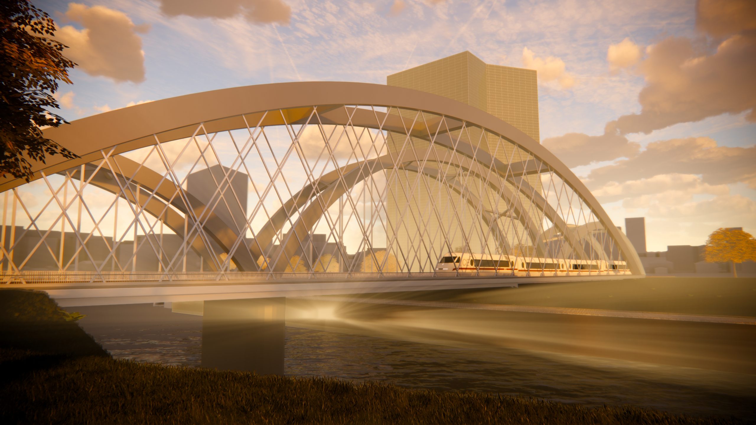
Frankfurt am Main hub – Deutschherrn Bridge feasibility concept
The Deutschherrn Bridge is a double-track rail bridge with a pedestrian walkway over the Main River in Frankfurt am Main. As part of the feasibility concept, DB Engineering & Consulting examined basic design variants for reconstructing the two tracks. The aim of the concept was to develop theoretically feasible design variants and to determine and compare their estimated construction time and the resulting route closures.
Construction engineering analyses and construction phases were developed and analyzed to determine the necessary construction times and work window durations.
At the request of DB Netz AG, the existing track centers on the listed Deutschherrn Bridge were to be investigated to see whether they could be increased from 3.50 m to 4.00 m, taking into account the required bypass solution over the train crossing on the Schlachthof Bridge and adjacent bridges, monument protection concerns, and maintenance of the current traffic relations and speeds in accordance with the Deutsche Bahn directory of locally permissible linespeeds (VzG).
All services provided were documented in the decision-making aid and completed with a comprehensive cost analysis. Finally, the preferred design variant was visualized.
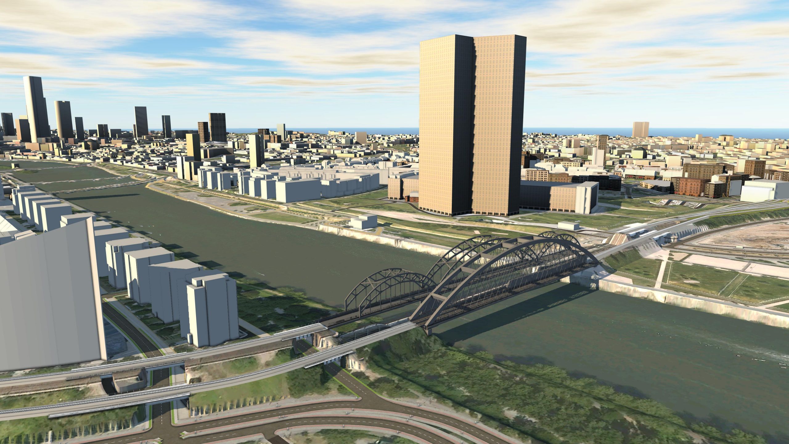
The Osthafen Bridge and the Oder Bridge are the reference structures for the Deutschherrn Bridge, as a network arch bridge. This bridge variant was considered in advance for the BIM visualization use case and represented accordingly.
A site plan with railroad and land lot boundaries (IVL plan) was used as a basis for the positional modeling. A 3D model was then created from this plan, which roughly corresponds in its cubature to the plans drawn up later in the feasibility concept. The 3D BIM model was only created as a visualization and does not serve as a planning basis for further planning steps.
The modeling of the structure is done using composite components. Here, individual project bodies were created, which roughly correspond to the requirements of the bridge in terms of their properties and cubature. In order to better represent the urban situation, the surrounding structures and properties were incorporated into the model for visualization reasons.
Project information
- Deterioration of the existing bridges
- New bypass plan
- Preparation of building concepts for different construction methods
- Analysis of the different transport concepts and their consequences
- Construction times/work window durations/construction phases
- Comparison between an unchanged restoration and a new construction in a different position
- Cost estimates
- Creation of a decision-making aid