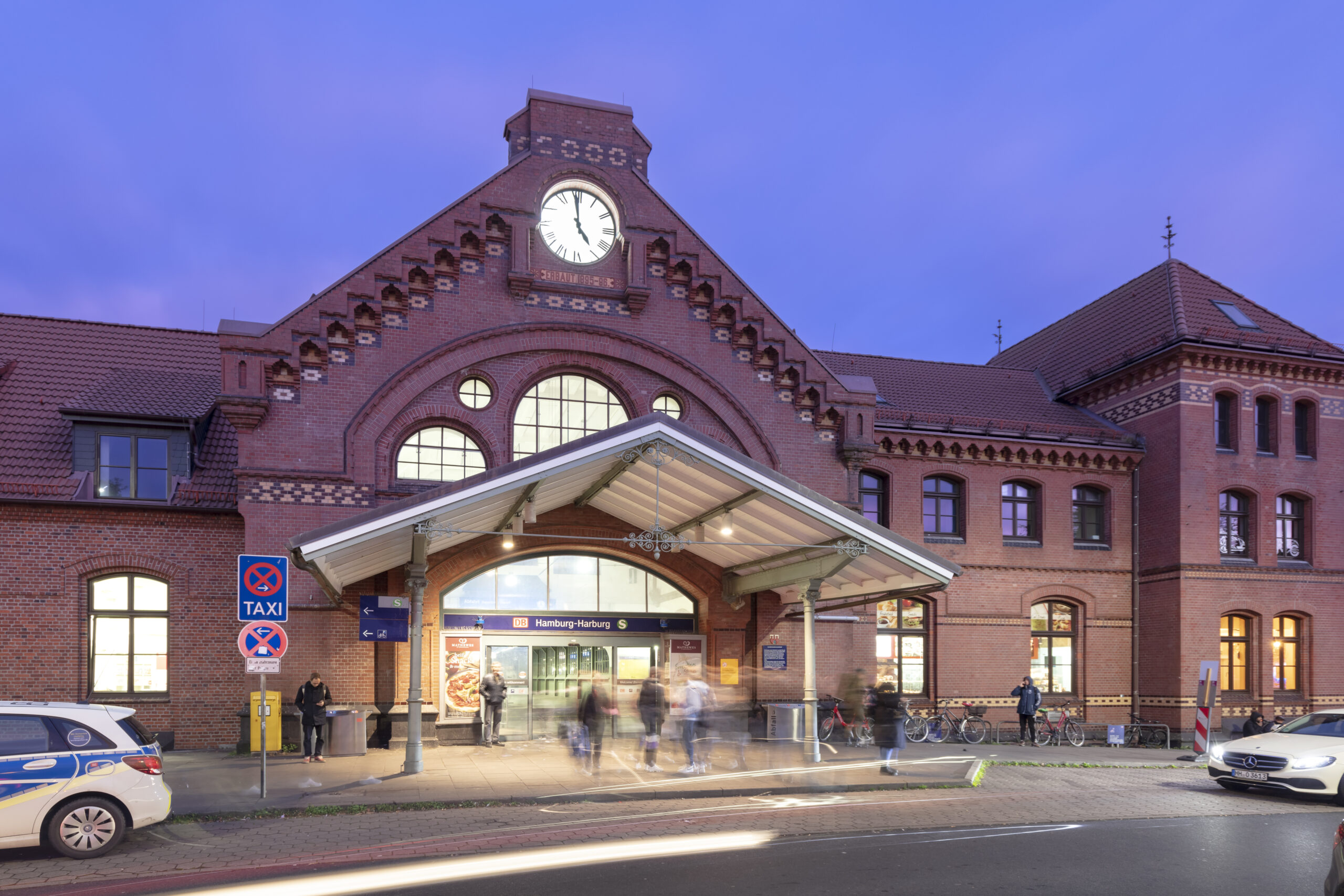
3D survey of Hamburg-Harburg station forecourt with X2BIM
On behalf of DB InfraGo, DB E&C carried out a comprehensive 3D survey of the Hamburg-Harburg station forecourt. The aim was to create reliable and complete georeferenced pre-design information.
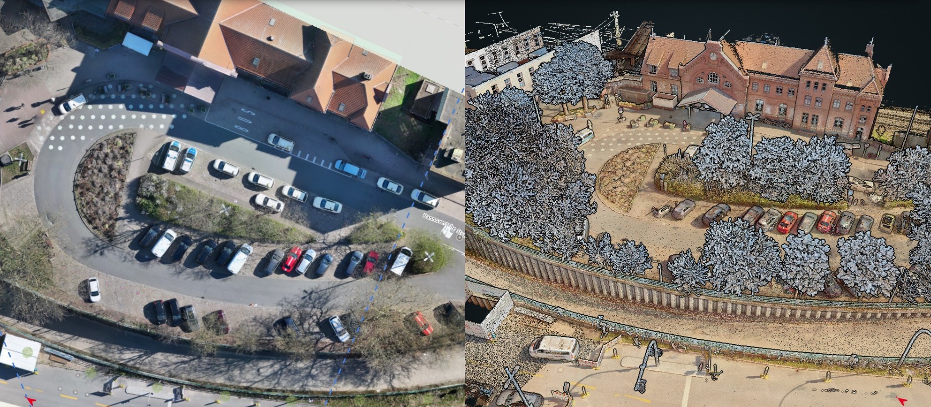
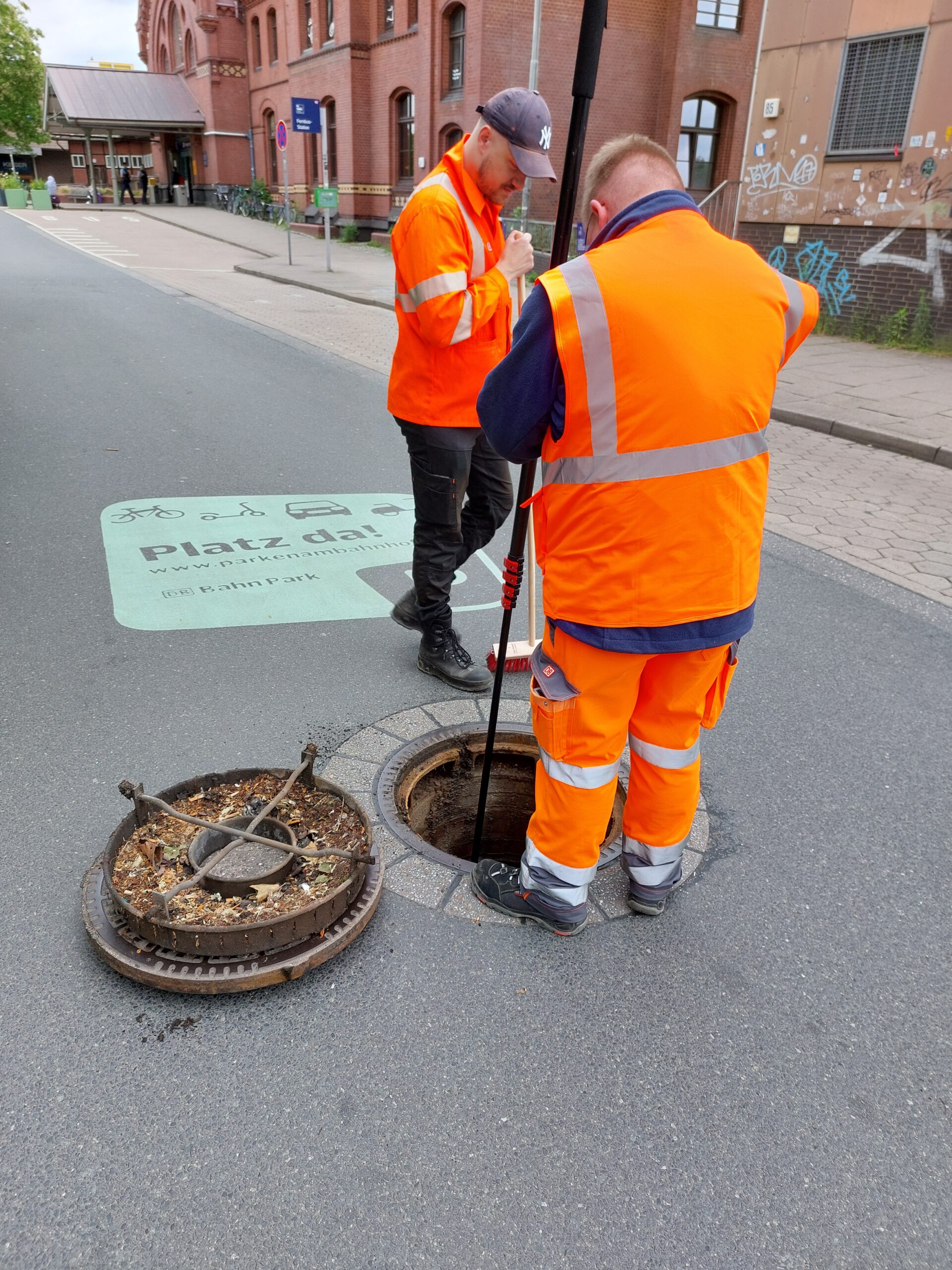
In April 2025, the area measuring approximately 10,000 m² was surveyed using multi-sensor technology: from the air using a multicopter, at ground level using a mobile mapping system and also using 360° cameras for over 30 manholes. Particular attention was paid to the pre-cise overlay of all data streams to ensure seamless georeferencing across all sensors. The data processing merged orthophotos and 3D point clouds in X2BIM. The manhole images were in-tegrated via Video2BIM and then made available on a central platform to make them easily accessible to users.
The approach focused on the prioritized added values of accuracy, speed, collaboration and pre-design information. Precise co-registration reduces additional inspections and creates a reliable basis for decision-making for project design at an early stage in proceedings. At the same time, lean data acquisition processes with drones and mobile mapping enabled efficient data collection within a tight timeframe, while the shared visualization provided by X2BIM facilitated interdisciplinary coordination.
The orthophotos and 3D point clouds were used to create a consistent dataset supplemented by technical data from the manhole surveys. The dataset also flags up potential conflicts in the early design phases. This shortens design cycles, minimizes misunderstandings and provides measurable support to the collaboration between design, construction and operation – on the basis of transparent, centrally available geodata for the Hamburg-Harburg station forecourt.
Project data
- Provision of a high-precision, georeferenced 3D as-built basis for further project and infrastructure design
- Visible upgrading of the forecourt with a view to future development potential
- Sustainable redesign of the intermodal hub in line with the decarbonization of mobility
- Multisensory survey of the approx. 10,000 m² station forecourt
- Airborne data acquisition by multicopter (drone)
- Ground-based surveying using a mobile mapping system
- 360° camera images for over 30 manholes
- Processing of data to create orthophotos and 3D point clouds
- Consolidation and visualization of all data in X2BIM
- Integration of manhole recordings via Video2BIM
Scope of services
The forecourt of Hamburg-Harburg station is to be fully surveyed using laser scanning at level of detail 3 (LOD 3) with an LOA of 5 mm and a measurement point density of less than 6 mm.
Surveying is required to create a 3D point cloud with at least the following content or information.
- An as-built plan on an official coordinate system
- Surface coverings by type of covering and whether paved or unpaved
- Installations such as boundary fences, fence systems, lights, masts, manholes, signs, walls, other rising structures, equipment and technical installations
- Position and height survey of manholes (top of center of manhole cover) and wastewater collection points (top center of cover), e.g. street drains, drainage channels and rainwater downpipes (top of transition from downpipe to ground)
- Height points: Driveways, entrances, stairs, edges, connection heights
- Trees with root base and crown diameter as well as trunk diameter for trees at a height of 1.30 m
- Parking spots
- Land parcels
- Extra: Location plan including coordinated utilities plan