360° Multisensor Platform
Precision data for effective design
360° Multisensor Platform
Precise three-dimensional data for efficient topography capture using the latest technological standards.
Obsolete or incomplete inventory data often creates obstacles to the design and reorganization of infrastructure projects, leading to delays. Today, there is still a need for data collection methods that won’t compromise the operations of the busy rail network. Precise, high-content, 3D data, consistent with the latest technical standards, is essential for capturing topography data efficiently.
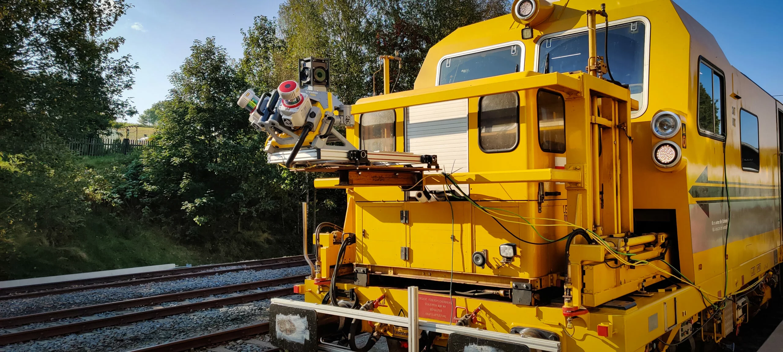
The 360° Multisensor Platform – developed in cooperation with DB BahnBau Gruppe – offers a solution. Integrated into rail vehicles traveling up to 80 km/h, the Multisensor Platform can be used to survey localities without hindering rail operations. Once processed, the 360° platform data provides useful resources for our experts, helping to maximize the time and cost efficiencies of design.
A range of different sensors (e.g. 3D laser scanners) are installed on the vehicle to allow different data to be captured synchronously in a single measurement run. The data is referenced as 3D point clouds, image panoramas and ground penetrating radar scans in the Deutsche Bahn coordinate system (DB_REF) and serves as a database for various projects.
Benefits at a glance
- Flexibility: Use in scheduled operations, with no line closures required
- Efficiency: High speed data acquisition (up to 80 km/h)
- Economy: Synchronous data capture with different sensor systems in a single measurement run (150–200 km/d)
- Eco-friendliness: Minimal time and materials required despite large data coverage areas and data diversity
- Cross-discipline collaboration: Shared use of the data, models and inventory data
- Data recency: Continuous expansion and updating of data
- Automation: Supported by a high degree of standardization
- Standardization: Pre-design information with a consistent level of quality
Data application
The Multisensor Platform offers comprehensive mapping of surface and subterranean topographies, with the help of point clouds, panoramic images and ground penetrating radar scans. Point clouds depict three-dimensional surfaces with a discrete set of millions of points. Each point position is identified by spatial coordinates. Panoramic images augment the point cloud data with a 360° spherical view of the surroundings. Ground penetrating radar scans survey subsurfaces to provide information on below-track conditions, generally down to a depth of approx. 4 meters.
Point cloud
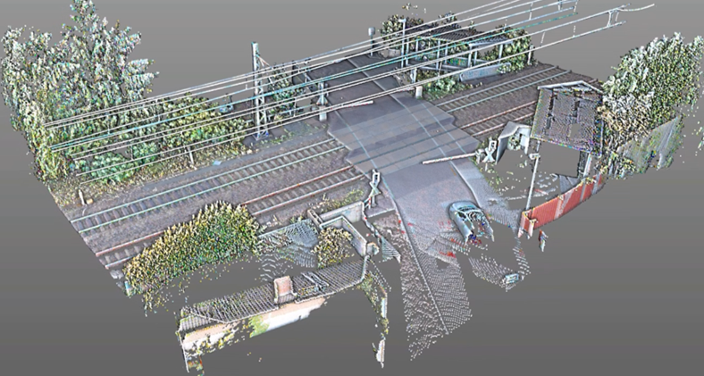
- High-definition, three-dimensional image of the real environment or a real object, acquired by various measuring techniques, e.g. laser scanning
- Modeling basis – efficient creation of 3D models with highly diverse levels of detail (LOD) and level of information (LOI)
- Pre-design model
- Always up-to-date – thanks to potential data updates and expansions
- Cross-discipline applicability – all as-built documentation integrated into a shared data model
- BIM-ready – offering an excellent foundation for BIM projects
Panoramic image
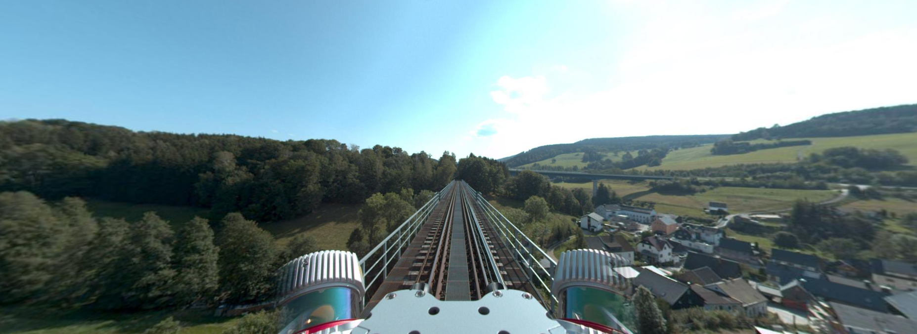
- Virtual on-foot line inspection
- Troubleshooting tool for identifying problem areas in advance – efficient and needs-oriented line inspection
- Design support – more detailed knowledge of locality
- Point cloud supplementation – simplified 3D modeling
Ground penetrating radar scan
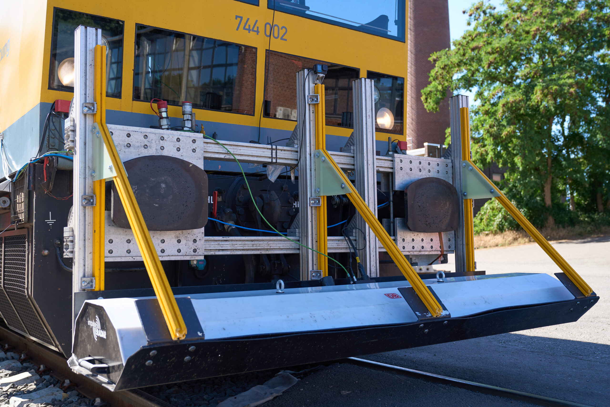
- Layer thickness measurements – surveying the roadbed and subgrade below the tracks (maintenance of way)
- Detection of irregularities – simplified 3D modeling
- Optimized geotechnical investigation – identification of, and concentration on, critical areas
Contact us
Want to know more about our 360° Multisensor Platform? Please complete the contact form and provide us with some information about you and your company so we can better prepare for our first meeting. We look forward to hearing from you.